Britain has rung in the New Year with heavy downpours and severe flooding with significant snowfall expected this weekend as the temperature is set to plummet in the first week of 2025.
A number of Met Office alerts are in place across large swathes of the UK and more than 170 flood warnings have been put in place across England, Scotland and Wales.
A three-day snow warning has been issued for almost all of England and Wales and parts of Scotland this weekend as the Met Office has warned rural communities could become cut off.
A yellow warning is in place from noon on Saturday until 9am on Monday and covers all regions of England other than the South West, the majority of Wales and parts of southern Scotland.
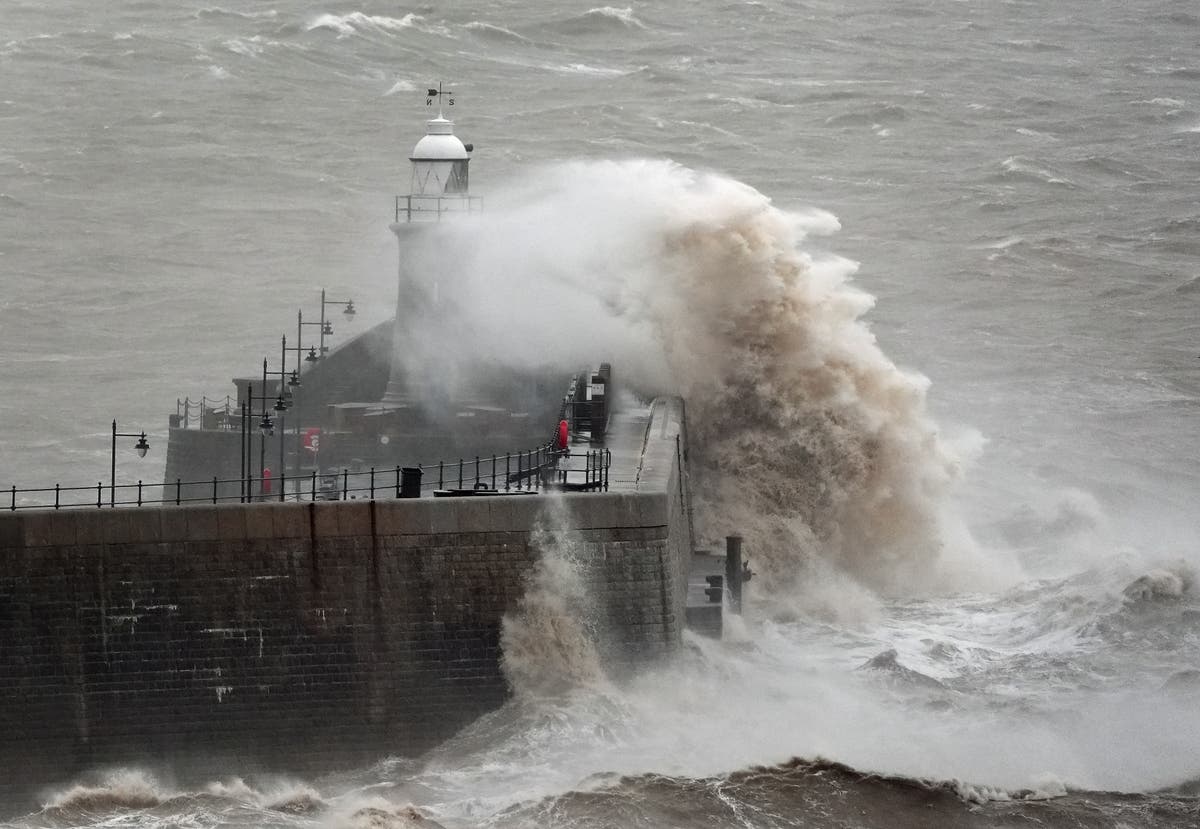
open image in galleryWaves crash against Folkestone harbour wall in Kent, as wind, rain and snow warnings are in force across parts of the UK (Gareth Fuller/PA Wire)
About 5cm of snow is expected widely across the Midlands, Wales and northern England, with as much as 20-30cm over high ground in Wales and/or the Pennines, the forecaster added.
Greater Manchester Police said a major incident has been declared over widespread flooding in the area following heavy rain overnight, with the worst affected areas in Bolton, Didsbury, Harpurhey, Stalybridge, Stockport and Wigan.
Mountain rescue teams have been deployed to help Greater Manchester Fire and Rescue Service deal with damaged properties and stranded vehicles.
open image in galleryA council worker attempts to unblock drains after heavy overnight rain (REUTERS)
Met Office meteorologist Tom Morgan said: “At the moment we’ve issued a very large snow warning for Saturday until Monday but it doesn’t mean that everywhere within that warning could see snow, it’s just a heads-up there could be some impacts.
“It’s definitely going to start off as snow in many places but it’s a question of how quickly that snow melts and turns back to rain, it’s more likely that the snow won’t last that long in southern England.
“It’s quite likely the warning will be updated quite frequently between now and the weekend.
“Certainly if you’ve got travel plans on Sunday and perhaps Monday stay tuned into the forecast.”
open image in galleryA drone view shows abandoned cars after heavy overnight rain caused roads to flood, leaving cars stranded in Manchester (REUTERS)
It comes as strong winds and heavy rain have been battering the UK as revellers celebrated the start of 2025.
A yellow wind warning is in force until 3pm on Wednesday for the majority of England and Wales, as winds of up to 60mph are forecast, with gusts of 75mph likely around coastal areas and hills, according to the Met Office.
The start of London’s New Year’s Day Parade was delayed by 30 minutes due to high winds being forecast, and inflatable cartoon characters were no longer going to be used, event spokesman Dan Kirkby said.
The North West and Wales have seen heavy rain for much of the morning on Wednesday, which comes after the Met Office said some parts of the North West saw almost a month’s worth of rain within 48 hours.
open image in galleryA yellow warning for snow will be in place until Monday morning (Met Office)
Honister Pass in Cumbria saw nearly 6in (150mm) of rain, while Rochdale in Greater Manchester had 3in (77mm).
In addition more than 170 flood warnings are in place across England, Wales and Scotland.
Ben Lukey, flood duty manager at the Environment Agency, said “significant inland flooding” is possible after “heavy and persistent rain” and river levels will remain high across parts of the north of England until Thursday.
He said: “Environment Agency teams will be out on the ground, operating flood defences, taking action to reduce the impact of flooding, issuing flood warnings and supporting those communities affected.
open image in galleryThe railway crossing at Blackford, Perthshire covered in snow (Robert Perry/PA) (PA Wire)
“We advise anyone travelling or out celebrating the New Year to be especially careful and urge people to stay away from swollen rivers and not to drive through flood water as just 30cm of flowing water is enough to move your car.”
A number of train routes have been disrupted or blocked by flooding, mainly in the North West of England, with some Northern services, TransPennine Express services, Transport for Wales services, and South Western Railway services affected.
National Highways has listed road closures including a section of the A628 Woodhead Pass between Woolley Bridge and Flouch, the westbound M56 between Junction 6 for Manchester Airport and Junction 8 for Bowdon and the M57 in Merseyside between Junction 6 for Kirkby and Junction 7 for Switch Island, Aintree.
open image in galleryA DFDS ferry arrives in stormy conditions at the Port of Dover in Kent (Gareth Fuller/PA Wire)
A snow and ice yellow warning is in place covering northern Scotland until 10am on Thursday, as rain turning to snow is likely to lead to some travel disruption and difficult driving conditions on New Year’s Day, the forecaster added.
Meanwhile, a yellow ice warning has been issued from 4pm on Wednesday until 10am on Thursday, covering Northern Ireland, parts of North Wales, England and Scotland, which could also lead to difficult travel conditions.
Additional reporting by PA
