Weather forecast: Will there be snow, wind and rain where I live?
Rain, snow and strong winds will hit the UK as 2025 gets under way, with a series of weather warnings covering much of the country coming into force between Monday and Thursday.
An amber alert for rain has been issued for parts of Scotland on New Year’s Eve, and stormy conditions are expected to spread to the rest of the UK.
Some warnings are already in place and conditions look set to deteriorate as the week goes on, raising the prospect of disruption impacting New Year’s events.
Sunday’s pre-Hogmanay Torchlight Procession in Edinburgh and a planned fireworks display in Blackpool are among the celebrations which have already been called off due to weather.
On Monday, the Met Office upgraded a rain weather warning for parts of northern Scotland on 31 December to amber, meaning flooding and disruption is likely until 17:00 GMT on Tuesday.
Forecasters expect areas of low pressure to bring unsettled conditions more widely across the UK on both New Year’s Eve and New Year’s Day.
That will eventually lead to a cold plunge of air from the north, with temperatures dipping below freezing for many.
Between Monday and New Year’s Eve there could be as much as 100-140mm (3.9-5.5 inches) of rainfall in some parts of western Scotland which could lead to localised flooding. There could be some further snow in northern parts of the country too.
There will also be spells of rain across England, Northern Ireland and Wales. The rain looks set to be particularly heavy in Wales.
While it will be windy everywhere, it could be especially blustery in the south of England as the new year is welcomed in.
EPA
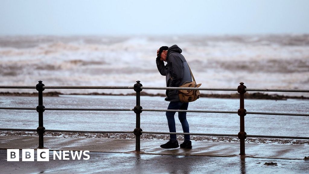
Strong winds have been forecast for parts of the UK, which has already seen high winds in December (pictured on England’s west coast on 22 December)
The weather warnings in place across the UK include:
- A yellow warning for wind covering the Pennines from 11:00 GMT until 18:00 GMT on Monday, and a yellow warning for rain and snow across Scotland from 00:00 GMT on Monday until midnight on Tuesday.
- An amber warning for rain is in place on Tuesday between 00:00 GMT and 17:00 GMT.
- Parts of northern England are covered by a yellow warning for wind from 07:00 GMT until 23:00 GMT on Tuesday. A separate wind warning covers Northern Ireland from 06:00 GMT until 14:00 GMT.
- Also on Tuesday, a yellow warning for snow is in place for Orkney and Shetland in Scotland from 05:00 GMT until midnight.
- A separate yellow warning for rain covers parts of Wales, the midlands and north-west England from 18:00 on Tuesday and 18:00 on Wednesday.
- On Wednesday, yellow warnings for snow and ice come into force, covering parts of northern Scotland, leading to some travel disruption in Aberdeenshire and Highland. It will stay in place until Thursday at 09:00 GMT.
- Also on Wednesday, a yellow warning for wind is in place for southern England from 07:00 GMT until midnight.
More widespread disruption is expected on New Year’s Day as another area of low pressure moves across the UK.
The strongest winds will be over England and Wales with gusts near 70mph (112km/h) over coasts and hills in the south and west.
About 30mm of heavy rainfall is expected widely across the UK. Rain is forecast to be heavier in Wales on Wednesday, which could bring some flooding.
Forecasters said 10-20cm of snow is expected in some parts of Scotland with heavier falls over hills with blizzards and drifting.
The Met Office said there was “potential for the pattern of warnings to shift and possibly escalate in some areas”.
Disruption is expected to continue on Wednesday night. By the morning of Thursday 2 January arctic air may sweep towards the UK as the area of low pressure clears into Europe.
From Thursday into next weekend it will be much colder everywhere with widespread frosts. Most places will be dry and sunny during the day but wintry showers will affect northern areas and lead to icy conditions.
The Scottish Environmental Protection Agency (Sepa) has urged people in the North West and Central Highlands to “be prepared, be aware” as flooding is expected.
Those attending Scotland’s biggest Hogmanay celebration in Edinburgh are being advised to dress for all weathers and check social media for updates.
Those travelling and with plans over the New Year are being urged to check the latest forecasts.
Network Rail said trains on some lines will need to be slowed down due to the difficult weather conditions.
The yellow weather warnings come after thick fog caused disruption to hundreds of flights at some of the UK’s major airports over the weekend.
Gatwick Airport reported continued delays on Monday, and flights at Manchester, Glasgow and Cardiff were also affected on Friday and Saturday due to poor visibility.
